Key objectives
- design and implement a transnational Geoportal supporting ICZM and MSP in the Adriatic-Ionian Region
- harmonise and prioritise data requirements for coastal and marine planning
- avoid duplication by inventorying and integrating existing tools and datasets
- develop analytical modules to support maritime spatial planning and ecosystem-based management
- test the Geoportal and tools through pilot actions in participating regions
Main results
The core result of PORTODIMARE is the development and operationalisation of a multi-purpose, modular Geoportal hosted by the Emilia-Romagna Region, ensuring sustainability beyond the project’s lifetime.
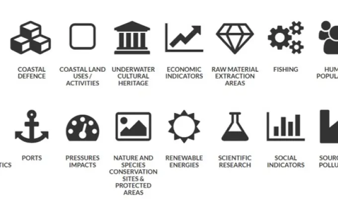
The Geoportal includes a series of analytical modules designed to support coastal and marine planning, including:
- analysis of conflicts and synergies among sea uses
- cumulative impact assessment of land- and sea-based pressures on marine ecosystems
- optimal siting of aquaculture farms
- dispersion modelling of contaminants
- coastal vulnerability to offshore oil spills
- mapping of the fisheries spatial footprint and fishing effort
These tools were tested through pilot actions across the Adriatic-Ionian Region, addressing issues such as biodiversity protection, sustainability of sea uses, spatial conflicts among maritime activities, coastal evolution mapping, and oil spill response simulations.
The project also produced practical guides for data preparation and Geoportal use, as well as maintenance and transferability plans to ensure long-term uptake and policy integration.
Role of PAP/RAC
PAP/RAC is a partner in all of the project WPs. It is directly responsible for:
- Implementation of pilot project activities in Albania, dealing with the assessment and development of proposals for the transformation of the small-scale fisheries sector, in line with EGD, through MSP.
- Support EGD-related assessment of MSPs in Malta and Croatia.
- Coordination of preparation of a technical paper on the role of Marine Spatial Planning in supporting the European Green Deal-driven development and transition of fisheries in the Mediterranean
Partnership
Lead partner:
Emilia-Romagna Region – Directorate General for Territory and Environment Protection (Italy)
Partners:
- CORILA (Italy)
- Regional Development Centre Koper – RRC Koper (Slovenia)
- Priority Actions Programme/Regional Activity Centre – PAP/RAC (Croatia)
- Hellenic Centre for Marine Research – HCMR (Greece)
- Institute for Physical Planning of the Primorsko-Goranska County – ZPUIZ (Croatia)
- Institute for Marine Biology – JPMDCG (Montenegro)
- CETEOR Sarajevo (Bosnia and Herzegovina)
- Consorzio di Bonifica/Coastal Protection Apulia – CP Apulia (Italy)
- Service OOMM Abruzzo (Italy)
- Regione del Veneto – RdV (Italy)